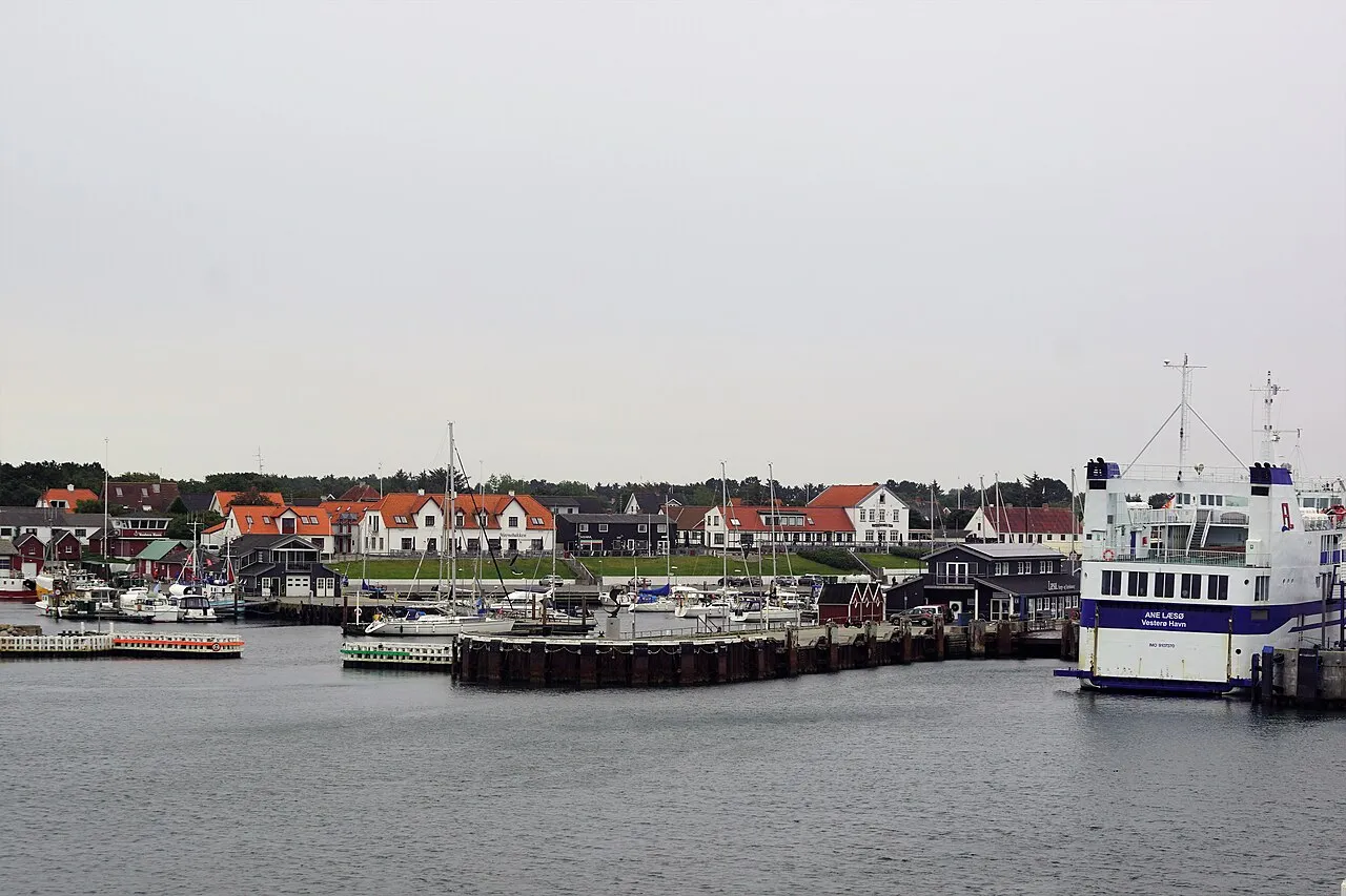

For visiting boats
Vesterø Havn on the west coast of Læsø is the ferry port for the Læsø ferry and also one of the busiest guest harbours in the Kattegat – in high season visiting yachts from Denmark, Norway, Sweden and Germany often lie rafted up. The harbour is owned by Læsø municipality and has three basins with room for about 250 boats. The approach is straightforward: a green buoy about 0.2 nm NW of the entrance and a green perch off the western pierhead, and there is no current in the entrance itself, although 0.5–2 knots can set along the coast. There is good sandy holding to anchor both north and south of the harbour. The net house in the middle of the harbour has the ticket machine, showers, toilets, laundry and a sailors' kitchen upstairs; there is diesel and petrol, a crane, a slipway, Wi-Fi and a grocer, and a long child-friendly beach right next door.
- Guest berths
- Pay at the ticket machine in the net house. In high season expect to raft up. Keep the ferry berth clear; max 3 knots.
- Berths
- 250
- Limits
- length up to 50 m · beam up to 12 m
- Radio
- VHF channel 12 · emergency VHF 16
- Position
- 57°17.85′ N 10°55.34′ E (57.29757, 10.92240)
- Fuel
- Fuel on site: diesel and petrol
- Phone
- +45 98 49 92 22
- UN/LOCODE
- DK VES
Prices
| Yacht up to 12 m excl. power | DKK 220 / night |
|---|---|
| Yacht 12–15 m excl. power | DKK 310 / night |
| Yacht 15–30 m excl. power | DKK 460 / night |
| Yacht over 30 m excl. power | DKK 700 / night |
Price list → · checked 18 Oct 2026 – prices may change
Services and facilities
© OpenStreetMap · OpenSeaMap — sea marks for the approach
Sailing here? Take VesselSOS with you.
- Family see you from shoreA live link in any browser – they don’t need the app.
- One tap to the right rescue centreHere JRCC Göteborg – the app switches centre as you move, with your position and call script even without signal.
- Return-time checkIf you’re not back in time, your people know.
- Shared hazard mapRocks, nets and other hazards reported by other boaters.
Frequently asked
Which VHF channel does the marina use?
VHF channel 12. In an emergency use channel 16.
Is there fuel at Vesterø Harbour?
Yes, there is fuel at the marina.
Who do I call in an emergency at sea here?
Sea rescue: JRCC Göteborg 112. On the radio: MAYDAY on VHF channel 16.