Free marine SOS · for anyone on the water

If something happened right now, who would you call?

No looking up numbers when it matters. In Maltese waters VesselSOS dials 112 in one tap; abroad it calls the rescue centre responsible for where you are. Either way it puts the words in front of you. Prepared for the worst day, built for every other one: the people at home can follow you, and what others have spotted in the water is on your map.

The SOS is free and needs no account. On iPhone; Android later.

Worried about someone out there? Send them VesselSOS

Boating elsewhere? AustraliaNew ZealandUSACanadaUKMaltaEurope
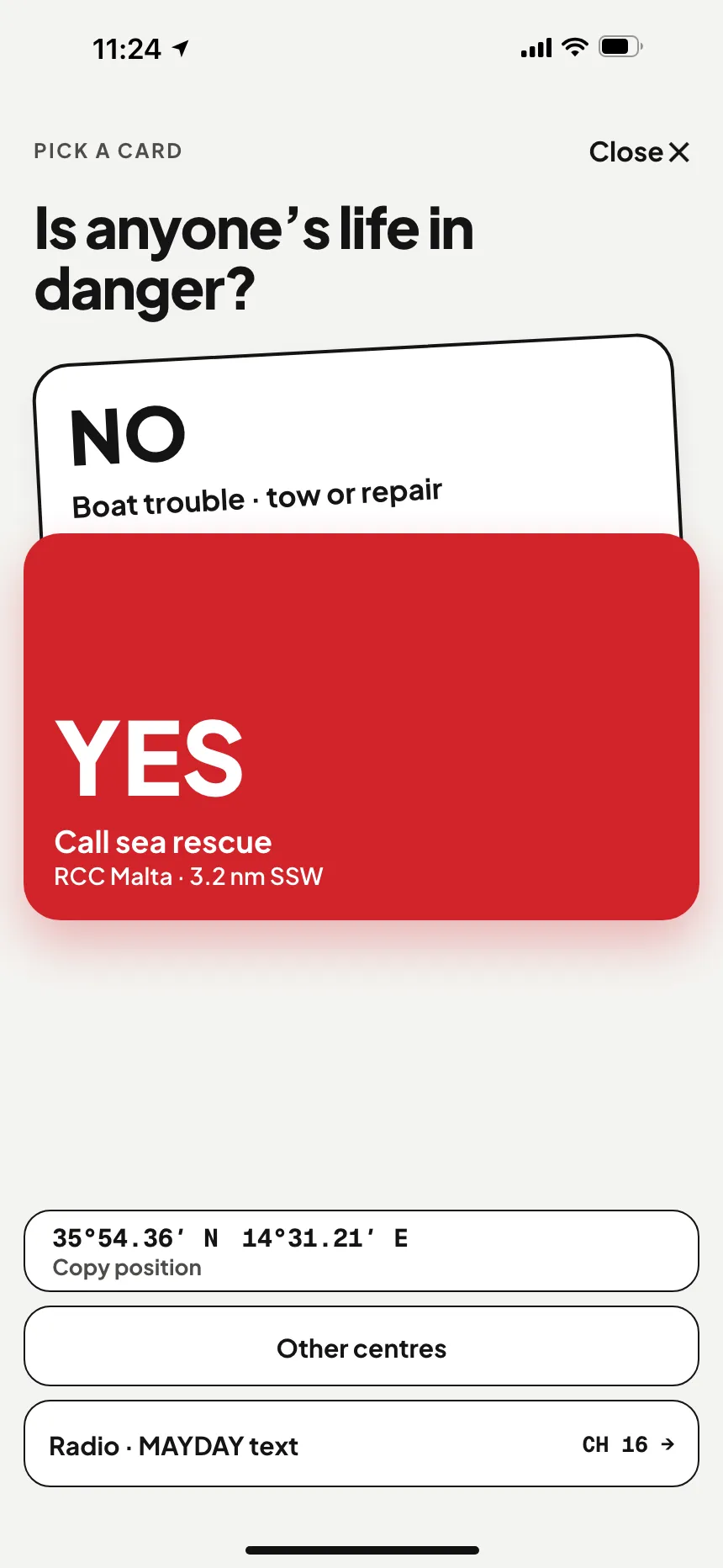
Marine SOS: is anyone's life in danger? Yes calls RCC Malta, no opens technical assistance · VesselSOS
SOS · free, no account needed The right call, in one tap Chosen by your GPS position, not by your phone’s country: 112 in Maltese waters, the responsible rescue centre abroad. You get a short script and your position in words.
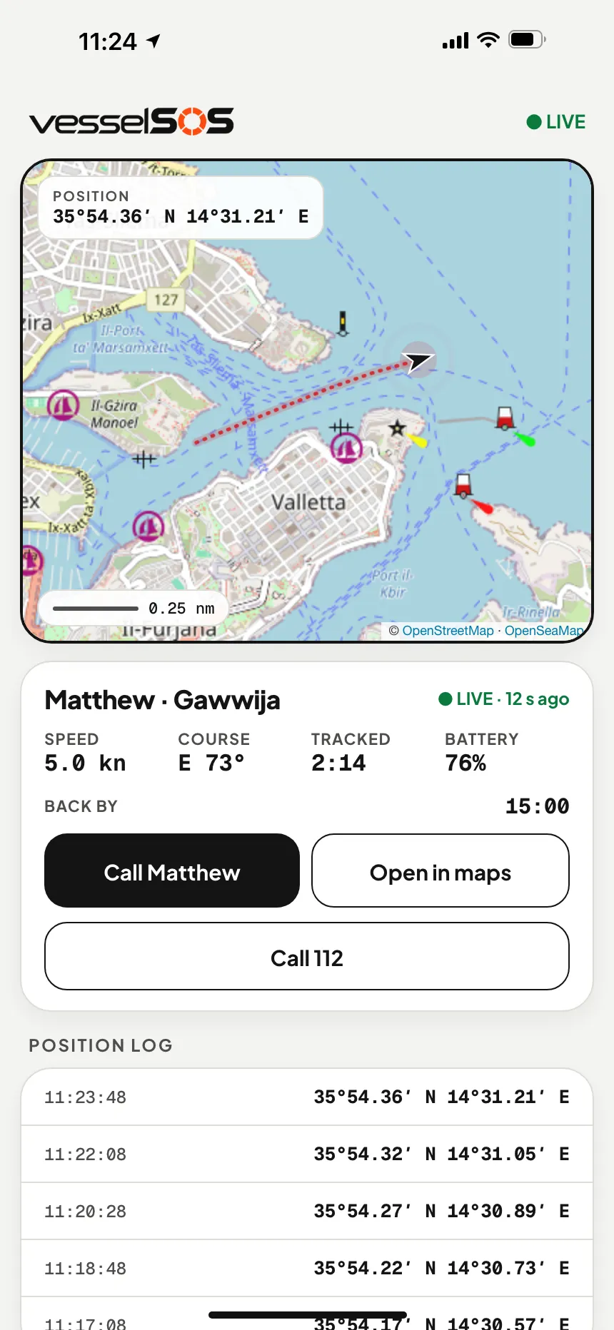
Live boat tracking link: the boat's position, speed and phone battery on a map in any browser · VesselSOS
Live position · Pro The people at home can see you Share a link that opens in any browser. If you’re not back by the time you said, they get a text with your last position.
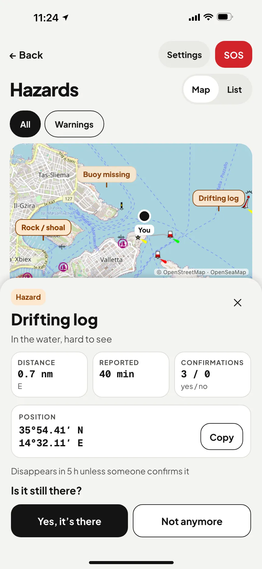
Hazard reports map: a drifting log, a missing buoy and a rock reported by boaters nearby; the log's position and confirmations · VesselSOS
Hazards See what others have spotted A drifting log, a lost net, a buoy that has moved. Reported by other users, confirmed by others, marked on the map.
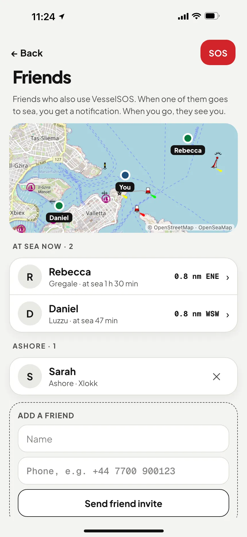
Boating friends map: two friends at sea near you with their boat, time on the water and distance, and one friend ashore · VesselSOS
Friends · Pro See who else is out Your friends on the same map. They only see you during a trip, and only if you choose to share.

The SOS is free and works without an account. Live tracking, the return-time text, friends and hazard reporting are part of Pro, with the first 14 days free. The hazard map is open to everyone.

SAFETY GEAR · PICKED FOR YOUR CRAFT

What do you take out?

Find your legal kit →

Heeled over, hands full — help is one tap away. MMSI and craft details ready in your call script.
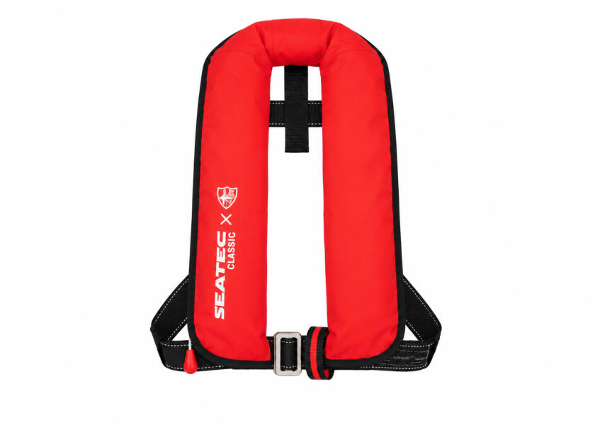
Auto lifejacket 150N
Inflates on contact with water.
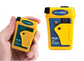
Personal locator beacon
Works where the phone can't.
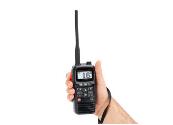
Handheld VHF
Handheld VHF
Channel 16 reaches boats nearby.
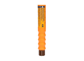
Flare pack
Flare pack
So they find you in the last mile.
KIT FINDER · RULES CHECKED 2 OCTOBER 2026 What safety gear do you need on the water? Five questions. You get what the law requires where you go — every line with its source — then what is worth adding for how you actually go out. Tick what you already have and the list shrinks to what is missing. 1Country2Craft3Range4People5On board Take the test →
Works offline.
GPS needs no network. Your position is always on screen.
By position, not SIM.
The rescue centre for the waters you're actually in.
Nothing to install ashore.
Your people open a link. That’s it.
LIVE TRACKING

Ashore, they see you. Live.

Tap “Going to sea” and text your chosen people a link. It opens in any browser and shows position, speed, course and battery — until you tap “I’m ashore”.

→ Nothing to install, no account on their side→ You decide who sees it — the link expires by itself
WHAT THEY SEE · ANY BROWSER
Live boat tracking link: the boat's position, speed and phone battery on a map in any browser · VesselSOS
FRIENDS AT SEA · HAZARD REPORTS

Your friends on the water. Hazards on the map.

One app and one account wherever you sail. Cross from Malta to Sicily and it keeps working the same way: GPS switches from RCC Malta to the responsible Italian centre (222 rescue centres in 118 countries), and friends and hazard reports work there too. We haven’t found another boating app that offers both (checked 10 October 2026).

Boating friends map: two friends at sea near you with their boat, time on the water and distance, and one friend ashore · VesselSOS
FRIENDS AT SEA · PRO

See which friends are out on the water.

Add friends by phone number. Once they accept, they see your name, number and main boat. When you head out with “Show friends when I’m at sea” on, they also see your live position, speed, course, battery, start time and planned return, and get a push notification when you set off and when you’re back.

→ Nothing is shown while you’re ashore→ One switch decides: “Show friends when I’m at sea”→ Works in every country the app covers
PROPUSH WHEN YOU SET OFF AND RETURN

Friends aren’t emergency contacts. If you’re overdue, the automatic SMS goes to your Emergency and Live contacts, never to friends.

Hazard reports map: a drifting log, a missing buoy and a rock reported by boaters nearby; the log's position and confirmations · VesselSOS
HAZARD REPORTS · MAP FREE

Mark a hazard. Warn the next boat.

A drifting log, a stray net, a squall, fog or a rock: report it in a few taps with its type and your position, and other boaters can confirm it. Anyone can open the hazard map, even without an account. With Pro you report and confirm hazards, and during a trip your phone alerts you to reported hazards nearby.

→ Reports expire by type, from 20 minutes to 7 days; confirmations renew them→ Tap a hazard for its coordinates, with a copy button→ Works in every country the app covers
MAP · FREE, NO ACCOUNTREPORT + CONFIRM · PRO

Reports come from other boaters and aren’t checked: they can be wrong, late or missing. They don’t go to RCC Malta or any rescue centre, and they never replace a lookout, charts or official navigational warnings.

Do you know which rescue centre is responsible for you right now?

Off Gozo, someone goes overboard. You know 112, but the operator still needs to know you’re at sea and exactly where. In Maltese waters search and rescue is coordinated by RCC Malta, run by the Armed Forces of Malta, across about 250,000 km² of sea; head further out and you can be in another country’s rescue area without noticing.

WITHOUT THE APP
1
You call 112
The operator answers. First you explain you’re on the water, not on land.
2
You describe the scenery
A bay, a tower on the cliff, a stretch of coast, in the wind, with a wet phone in one hand.
3
They work out where you are
Every question about “where” is a minute nobody is on the way.
4
Meanwhile, you drift
Away from the last place anyone saw you.
WITH VESSELSOS
1
The app knows who’s responsible
RCC Malta in Maltese waters, the right centre once you cross into another country’s area, chosen by your position.
2
One question, then it dials
Is a life in danger? Yes, and the app calls 112 in Maltese waters at once, with what to say ready for when the operator answers.
3
The words are already written
Who you are, where, what happened and how many on board, line by line, in English.
BY POSITION, NOT SIM CARD 30 EUROPEAN COUNTRIES

Life at risk — or just a dead engine?

THE APP ROUTES YOU TO
Search & rescue · 112 · VHF 16

With a radio, a DSC alert and a MAYDAY on VHF 16 reach the coast station and every boat listening, and the app shows the script. By phone, it dials 112 with your position and a word-for-word script on screen. It never gets between you and search and rescue; it makes the call faster.
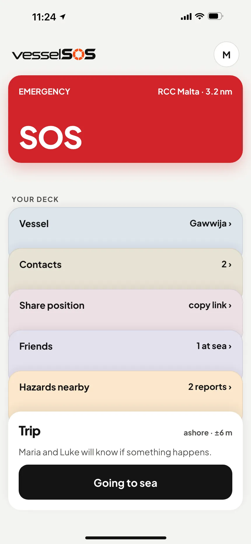
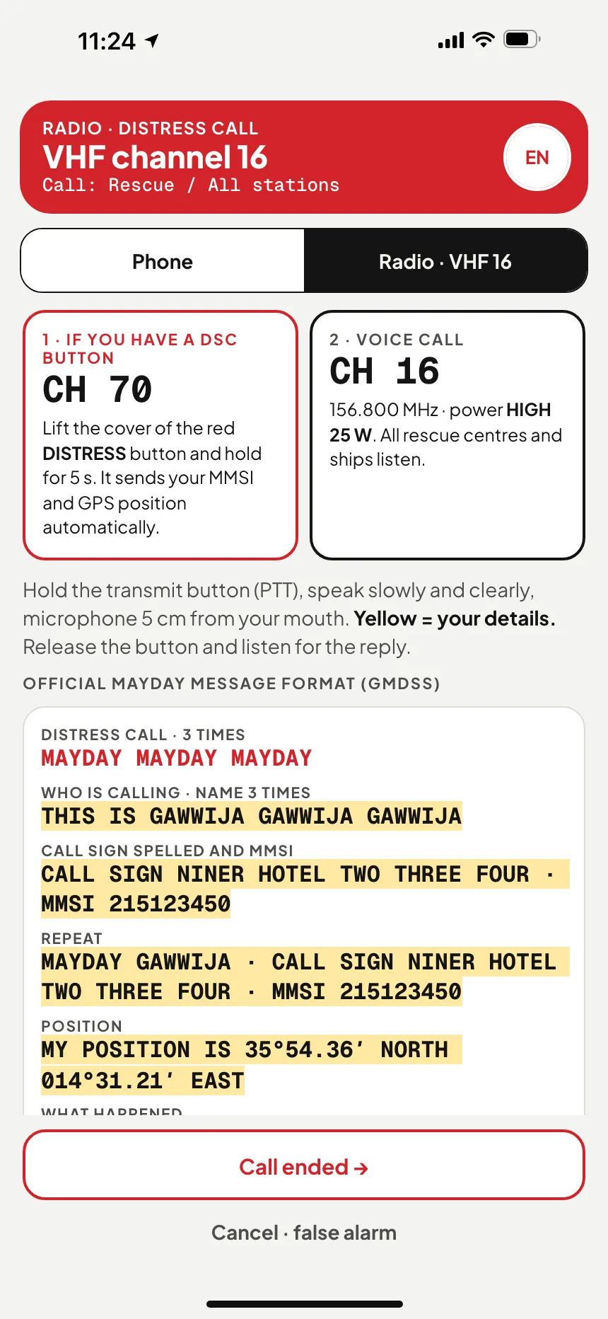
Boating safety app home screen: SOS button and the responsible rescue centre, RCC Malta · VesselSOSMarine SOS: is anyone's life in danger? Yes calls RCC Malta, no opens technical assistance · VesselSOSVHF MAYDAY call: channel 16 distress message filled in with the boat's name, call sign and position · VesselSOS
THREE STEPS

Nobody recalls coordinates in a panic.

01
Press SOS

One big red button, on every screen. Your coordinates are ready, no signal needed.

02
Answer one question

Is anyone’s life in danger? Yes dials 112 in Maltese waters at once. No keeps 112 free and opens technical assistance.

03
Read it out

Step by step: who you are, where, what happened. On the radio, the official MAYDAY with your call sign in the NATO alphabet.

The SOS screen is free. Forever.

Calling for help never sits behind a paywall. Pro adds live tracking, your contacts and the return-time check.
FREENO ACCOUNT
0 €
FOREVER
SOS screen with your positionResponsible rescue centre, one-tap callMAYDAY script + coordinates by SMS
PRO · YEARLY14 DAYS FREE
19.99 €
PER YEAR
Text your SOS and a live link to your contactsReturn-time check: your contacts get an SMS if you are lateLive tracking, craft profile, trip history, friends at sea, hazard reports
PRO · MONTHLY14 DAYS FREE
2.99 €
PER MONTH
The same Pro features, billed monthlyCancel any time in the App StoreComing: internet calls to a rescue centre’s ordinary number (not 112, needs data)

Pro is bought in the app through the App Store and renews automatically until you cancel; the 14-day free trial is once per person. Coming to Pro: calls routed through a phone-network gateway to a rescue centre’s ordinary number, for when you have no SIM, roaming fails or you only have satellite internet; it can’t reach the 112 short code and it needs a data connection.

What VesselSOS does not replace.

A beacon is a beacon. This is the backup that's always with you — on most small craft, the only thing there.
EPIRB Satellite beacon registered to the vessel Anywhere, mid-sea included Cospas-Sarsat → rescue centre See the gear
PLB Personal beacon on your lifejacket Anywhere with open sky Same satellites, tied to a person See the gear
VHF-DSC Radio with digital distress alert ~30 nm from shore and vessels Nearby vessels + coast station See the gear
VesselSOS The phone that’s with you anyway Mobile coverage (later also satellite internet with Pro — not 112, needs data) 112, the rescue centre and your people Get the free app
BEFORE YOU LEAVE THE DOCK

Four minutes, once.

01
Your phone number
An SMS code instead of a password. It also goes into the call script, so rescuers can call back.
02
Add the craft
Name, type, length, colour, MMSI, call sign — the first things you'll be asked.
03
Choose your people
As many as you like — each set to None, Emergency or Live.
04
Allow location
“Always”, so tracking works with the phone locked — stored only during a trip, an SOS or a one-hour link you start.
CLUBS & MARINAS

Clubs and marinas near you

Sailing, rowing and paddling clubs and guest harbours — with VHF channel, depth, prices, weather and the rescue centre for their water. Free to use, no account needed.

Questions people actually ask.

Who answers when I call 112 from a boat in Malta? +

The 112 call centre first. The Armed Forces of Malta say emergency AFM assistance “can be requested over the 112 system that is quickly routed from the 112 call centre directly to the AFM OPCEN”, the operations centre where RCC Malta sits. So say straight away that you’re at sea, then where you are.

Does the app call RCC Malta directly? +

No. In Maltese waters “Yes, a life is in danger” dials 112, which is how the AFM asks to be reached, and the screen shows your position in words and what to say. The app isn’t connected to 112, the AFM or any rescue centre: it dials the call and shows you the words. Elsewhere in Europe it picks the responsible rescue centre by your position.

What about the radio? +

Use VHF channel 16 for distress (DSC on channel 70). The AFM keeps a continuous watch on the distress frequencies; it says its VHF coverage reaches about 20 nautical miles. Further out, carry an EPIRB or PLB: a phone won’t reach shore there either.

Which rules should I know in Maltese waters? +

A few from the Small Ships Regulations: small craft used in Maltese waters must be registered with Transport Malta (a boat registered abroad can be exempt), you need a nautical licence to drive a boat of 30 HP or more, and the speed limit is 10 knots inside harbours, within 300 m of a sandy beach and within 200 m of the rest of the shore. Transport Malta also requires a passage plan and lays buoyed swimmers’ zones in summer.

Does VesselSOS replace an EPIRB or PLB? +

No. A beacon works where there is no phone network at all, which in the Malta search and rescue region is most of the sea. VesselSOS is the fast backup that’s there even when a beacon isn’t.

How much battery does it use? +

Ashore, next to nothing: outside a trip, an SOS or a share link the app doesn’t track you; while it’s open it only checks hazards nearby, using an approximate position. During a trip it reports in the background at the interval you choose (every 30 seconds by default, roughly 4% an hour by our estimate), and drops to every 5 minutes below 20% battery. The people watching see your battery level.

What if I don’t come back on time? +

Set a return time when you leave. If you haven’t ended the trip by then, your phone asks “Are you OK?”. If you don’t answer, our server texts up to 5 of your Emergency or Live contacts at your return time plus your chosen delay plus 10 minutes, with the live link, and sends an all-clear once you answer. It needs mobile data at least once after you set off, and it never alerts a rescue service. Maltese numbers work; numbers in the US, Canada, Australia and New Zealand aren’t supported yet.

Can my friends see where I am? +

Only while you’re on a trip with “Show friends when I’m at sea” on. Then friends who accepted your invitation see your position, speed, course, battery, start time and planned return, and get a push notification when you set off and when you’re back. Ashore they see only your name, number and main boat. Friends aren’t emergency contacts: the automatic overdue SMS goes to your Emergency and Live contacts, not to friends. Friends is part of Pro.

How do hazard reports work? +

Anyone can open the hazard map, even without an account. With Pro you report a hazard (its type and your position) and confirm other people’s reports. Reports expire by type, from 20 minutes to 7 days, and confirmations renew them; fixed hazards such as rocks stay until removed. During a trip your phone alerts you to reported hazards nearby. Reports come from boaters and aren’t checked, they don’t go to RCC Malta, and they never replace a lookout, charts or official navigational warnings.

Be aboard first.

We're testing on iOS now. We'll email you the day it opens to everyone in the App Store — Android follows.

Launch email always included. Never shared or sold, one-click unsubscribe. Privacy notice

IMPORTANT

VesselSOS is an aid, not a rescue service. It doesn’t replace a VHF radio, an EPIRB or PLB, a lifejacket or a 112 call, and it depends on your phone’s battery, GPS and coverage.

SUPPORT

A human answers within one working day.

support@vesselsos.com