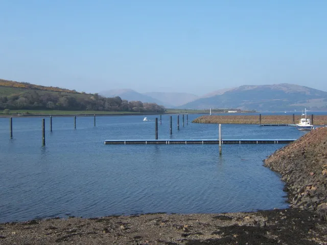

For visiting boats
Port Bannatyne Marina is a family-run marina in Kames Bay on the Isle of Bute, at the gateway to the Kyles of Bute. It has around 108 berths for boats up to 16.5 m, dredged to 2.4 m below chart datum, with all-tide access and a stone breakwater for shelter. Pontoons have water and power, and facilities include free Wi-Fi, 24-hour toilets and showers, a pump-out, a 25-tonne sublift hoist, storage ashore and undercover, a chandlery, and a full repair and maintenance yard run by its partner company. Rothesay is a short bus ride away.
- Guest berths
- Port Bannatyne Marina is in Kames Bay on the Isle of Bute, at the entrance to the Kyles of Bute, about 3 miles north-west of Rothesay. It is dredged to 2.4 m below chart datum and can be entered at all states of tide, and a stone breakwater shelters it from southerly and easterly winds. Visitors berth on Pontoon D. The marina is busy, so book ahead by phone. Call on VHF 37 (M1 or P1). Fuel is available by can only.
- Berths
- 108
- Limits
- draught up to 2.4 m · length up to 16.5 m
- Radio
- VHF channel 37 · emergency VHF 16
- Position
- 55°51.68′ N 5°5.18′ W (55.86131, -5.08626)
- Fuel
- No fuel at the marina.
- Office
- Office open 7 days a week; phone answered 24/7
checked 19 Oct 2026 - Phone
- +44 1700 503116
Prices
| Overnight berth per metre, incl. VAT | £3.50 per m / day |
|---|---|
| Weekly berth, 7.4 m and over per metre, incl. VAT; £18.90 for 6–7.3 m | £21.50 / week |
| Monthly berth, 7.4 m and over per metre, incl. VAT; £55.12 for 6–7.3 m | £65.50 / month |
Included in the berth price: water and wifi. Price list → · checked 19 Oct 2026 – prices may change
Services and facilities
© OpenStreetMap · OpenSeaMap — sea marks for the approach
Sailing here? Take VesselSOS with you.
- Family see you from shoreA live link in any browser – they don’t need the app.
- One tap to the right rescue centreHere Belfast Coastguard – the app switches centre as you move, with your position and call script even without signal.
- Return-time checkIf you’re not back in time, your people know.
- Shared hazard mapRocks, nets and other hazards reported by other boaters.
Frequently asked
Which VHF channel does the marina use?
VHF channel 37. In an emergency use channel 16.
How deep is the marina?
It takes boats with up to 2.4 m draught. Maximum length 16.5 m.
Is there fuel at Port Bannatyne Marina?
There is no fuel at the marina.
Who do I call in an emergency at sea here?
Sea rescue: Belfast Coastguard 999. Or call 112. On the radio: MAYDAY on VHF channel 16.